Drone Operations
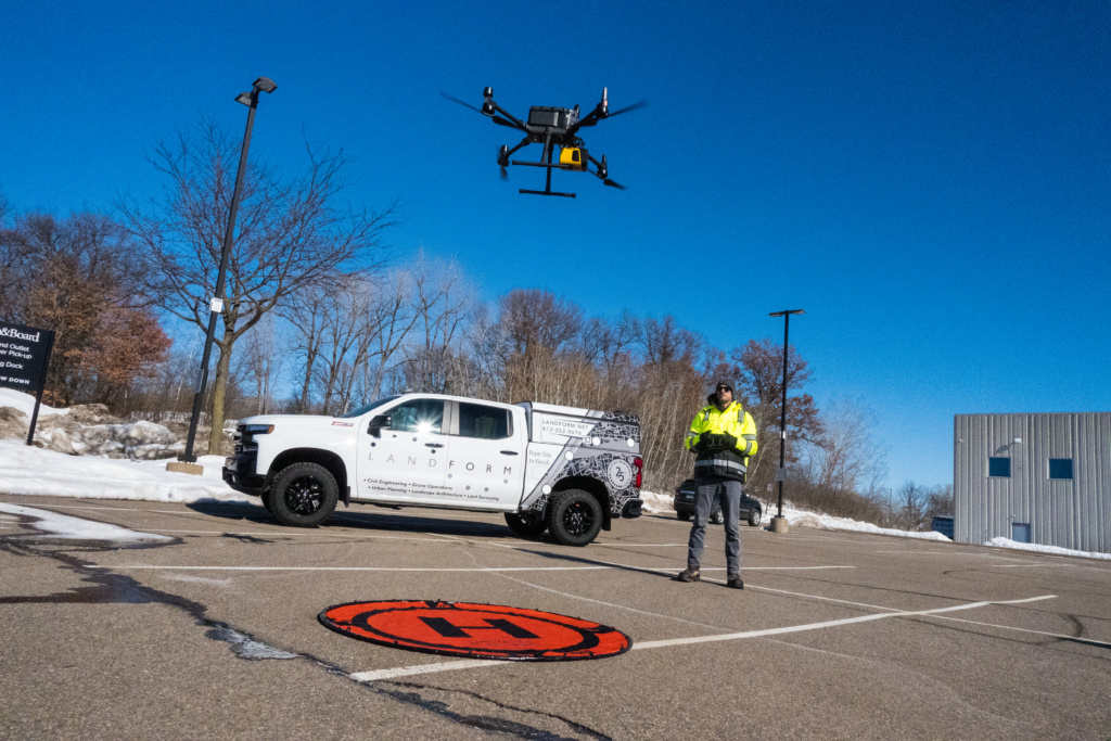
Landform’s Drone/LiDAR/Manned Aircraft Operations team combines the latest, innovative drone technology with top-notch industry software to produce the premium content our clients demand.
Whether you need to enhance your marketing, survey grade topography, thermal sensing, 3D modelling, site comparison, or more, the Landform Aerial Operations (Drone/LiDAR/Manned Aircraft) team can significantly save your company time and money.
Why Landform’s drone operations team?
There are several reasons why choosing the experts on our team can be beneficial:
- Legal Compliance: The FAA Part 107 certification is a requirement for commercial drone pilots operating in the United States. By choosing our Drone Operations team, you can be assured that they have the necessary certification and are operating legally for your project.
- Experience: With more than half a century of combined experience, our Part 107 Drone Operations team understands drone technology and its capabilities better. They have encountered a wide range of scenarios and challenges and know how to adjust their approach to achieve the best results for our clients.
- Safety: Our certified pilots are trained in aviation safety, which means they know how to operate drones safely and avoid potential hazards. They are also required to follow strict operational guidelines set forth by the FAA, which include maintaining line of sight, flying under 400 feet, and more.
- Quality of Work: Landform pilots and technicians have gone through rigorous training, experience and testing to obtain their certification and master their craft, which means they have a solid understanding of drone technology and how to use it effectively. This translates into a higher quality of work and more accurate data collection.
- Professionalism: By choosing our drone team, you can be assured that they are operating in a professional and ethical manner. Part 107 certified pilots are required to follow a strict code of conduct, which includes respecting privacy, obtaining necessary permissions, and maintaining confidentiality.
Overall, choosing our Drone Operations team provides more professionalism, safety, and legal compliance than non-certified operators – enabling them to adapt their approach to achieving optimal results for our clients.
What are the benefits of using drones?
There are several reasons why using drones for surveying is becoming increasingly popular, including the following:
- Speed and Efficiency: Drones can cover large areas quickly and efficiently, reducing the time and cost of traditional surveying methods.
- High-resolution imagery: Drones can capture high-resolution images that can be used to create detailed maps, 3D models, and other surveying products.
- Enhanced Safety: Using drones for surveying can reduce the need for surveyors to work in hazardous or hard-to-reach areas, reducing the risk of accidents or injuries.
- Access to remote areas: Drones can access areas that are difficult or dangerous for humans to reach, such as steep slopes, rugged terrain, or areas with limited accessibility.
- Improved Accuracy: Drones equipped with GPS and other sensors can provide highly accurate data that can be used for surveying, mapping, measurement, and analysis.
- Cost-effective: Using drones for surveying can be more cost-effective than traditional surveying methods, requiring fewer personnel, equipment, and resources.
- Versatility: Drones can be used for a wide range of surveying applications, including land surveying, construction, mining, agriculture, and environmental monitoring.
- Flexibility: Drones can easily adjust their altitude, position, scan frequency, and methodology to capture specific data points or angles, allowing for more accurate and precise data collection.
Overall, using drones for surveying offers several advantages over traditional surveying methods that can lead to faster, safer, and more accurate surveys, making it a popular choice for us to use to help our clients save time and money.

What are the advantages of our drones?
After hundreds of hours flying and evaluating multiple drone manufacturers, our team have selected the best-in-class drones delivering several advantages for our clients, including:
- High-quality cameras: We use only the best drones with high-quality cameras, allowing us to capture stunning aerial photos and videos.
- Advanced features: Our drones are equipped with advanced features like obstacle avoidance sensors, GPS, intelligent flight modes, and more, which make flying more accessible, safer, and more efficient.
- Versatile: We offer a wide range of drones catering to our client’s needs and budgets.
- Reliable: Our drones are known for their increased reliability and durability, with many models designed to withstand harsh weather conditions and rough handling, which is necessary for Minnesota.
- Safety: Our drones are equipped with the latest, premium technologies such as GPS, obstacle avoidance sensors, and intelligent flight modes, allowing more accessible, safer, and more efficient flying.
Our fleet of drones offers a premium range of advantages, making them the best choice for our Drone, LiDAR, and Manned Aircraft Operations team.
Not sure which Aerial Operations service is right for you? Download our easy-to-understand comparison chart, or contact us today to review a case study.